Rick Shory

Offering a little something you might not otherwise have


Leave a comment

Yellowstoned Again, part 4 of 4

While waiting to find out from Yellowstone, we rearrange our plans.  We spend two weeks mopping up other plots in Wyoming, closer to roads.

I feel weird about having an injury nobody else can see.  When Bill rolled a sharp rock and slashed his leg, the hospital where they stitched it up thought it looked like a knife wound.  When Crow woke up one morning so sick we took him to the E.R. in Rawlins, at least he was throwing up and feverish (best conclusion, much later, was a spider bite).  My own condition, the only sign is my own complaints; and I hate to complain.


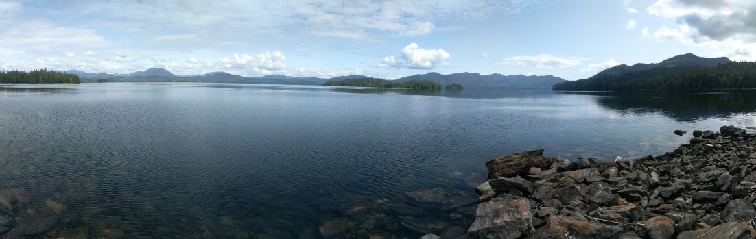
Everywhere we go, people see our Forest Service green rig and ask if we’re up there fighting fires.  The blazes are in full force, the bad fire season predicted by the warm and dry spring.  The smoke near Thermopolis is so thick it darkens the sky and colors the sun sunset red at midday.

“No,” we explain, “We’re the one part of the Forest Service that doesn’t fight fires.”  In fact, our work, forest inventory, is even higher priority than firefighting.  One guy asks how to get a firefighter job.

At one time, maybe I thought firefighting was romantic.  If I hadn’t already changed my mind, Bill’s talk would’ve convinced me.

“You’re working out on the line, digging in the dirt.  Chopping.  You’re filthy.  You don’t get enough rest.  Maybe grab a few hours in your sleeping bag in the ditch.  And along the line you got this military type guy all the time yelling at you, ‘Faster!  Faster!'”

I think I could handle that, but I’d have a problem with it so boring.  The same mindless motion all day.

Smoke from the Blondy fire, view west of Thermopolis.

Smoke from the Blondy fire, view west of Thermopolis.

Now, it’s the weekend before the Lamar Valley.  We’re in Cody.  We’ve been through Cody three or four times already this summer.  It’s a nice town, a good size.  Big enough to have things, but small enough it’s not crazy.

All I knew about Cody before staying here was Buffalo Bill.  Colonel Cody founded this place around 100 years ago, and still lives on in spirit.  The spirit is that you come here to have fun.  He had his Wild West show, and Cody continues the same tradition.  The town is touristy, and strategically placed east of Yellowstone, about as close as you can find reliable weather.  It’s the nearest real town that direction.

Cody has a lot of attractions, for a place that could pass as a little snippet of the Midwest at first glance.  There’s rafting on the Shoshone River, right past the bluffs below the neighborhoods.  There’s a huge Buffalo Bill Western museum, and a Native American arts center.  Our first stay of the summer, they were having a powwow, with flocks of costumed Indian dancers.  Cody has a Frontier Town, fairly well done, amidst all the tacky motels at the west edge.  There’s sharpshooters, and outlaw reenactments, and fly fishing.  And, every night, a rodeo.

The rodeo clown tells lame jokes.  Well, he’s probably got a lot of good mileage out of them.  “Hey, that there’s a teenage horse.”  He pauses for effect.  “Wants to stay out all night!”  The broncos, after dumping their riders, frequently have high energy and run around and around the ring.  Hard to corral them back into the stables.  The clown serves the purpose, among others, of keeping the crowd amused while this housekeeping is tended to.

The riders are mostly young, teens and twenties.  The announcer gives some rodeo history.  These skills grew out of ranch work in the old west, and finally codified into competition.  I’m impressed with the calf roping.  I would be challenged to even stay on a horse at gallop, let alone throw a rope while doing it, and at a moving target.  It’s amazing most of them even get close.

Some of the buckers are what they call “come apart” horses.  Like, it was a good working horse for a time, then “…just up and come apart,” started bucking, and couldn’t be ridden any more.  And so had a future in rodeo.

I learned something else about the bucking broncos and bulls this summer that changed my picture of it all.  Animal rights activists are complaining rodeo is cruel.  The system responds with information, Sunday supplement articles and the like, on how the animals are kindly managed.  The bulls and horses spend their time, when not on the circuit, in quiet pastures, by winding rivers, beneath shady trees.  They are treated well.  The business is in the hands of one or a few families who never sell their livestock, in the interest, they say, of maintaining standards high.  These animals are bred, for generations, to buck; and are only rented out to do it.  At the rodeo, each run from of the chute lasts mere seconds.  These mounts only have to “work” a total of perhaps an hour or so in their entire lives.  Humane?  Certainly!

They should all be shot!  What’s the use of a horse you can’t get any work out of?  A weird world we live in, that trafficking in these particularly useless steeds is big, and highly profitable business!  Well, whatever!

The young riders come from all over.  Florida.  Virginia.  Some from local Meeteetse.  I get the impression few of them are ranch kids.  But I admire their dedication.  It takes a lot to get all the equipment, to practice, and take their chances on being maimed for life.

Years ago, I met a young guy who rode rodeo.  The business of his family was well-drilling in Klickitat County, Washington.  His mom, he said, wouldn’t let him ride until he could put up his own money for insurance.  If that’s typical, these guys have an expensive hobby!  That on top of, in each rodeo, having to pay to compete.  Sure there’s prize money, but it can’t be a living.


We’re in Cody the weekend before the Lamar Valley.  My foot feels pretty good, but I figure I better test it.  I get my full pack and go hike a few hours down by the river.  The results are bad.  Back at the room, my foot feels the same as when I first tweaked it.  It’s decision time.

This doesn’t really hurt, but it feels wrong inside.  I can trek, but what if it gets bad up in the woods?  If I need to bail, someone would have to hike out with me.  And that means both, because one alone would not be safe, nor able to get the job done by remaining.

I drive myself down to the ER.  I need an outside opinion.  I make it clear, at the desk, this is not a pressing trauma.  Any others can go ahead of me, and I brought plenty to read.

The emergency room scene is colorful, as always.  There are a couple of bikers, and their friends, in for a motorcycle crash.  Not too serious.  The victim is in good spirits, regaling everyone with jokes.  Half the summer, all of Wyoming has been crawling with hawgs, overflow I guess, from Sturgis 2000.  They’re considerate, and well received, but inevitably someone must have a mishap.

I finally figured out what I like about the biker scene, aside from how some of the guys look.  It’s not a “family” trip!  I got nothing against families, but it gets cloying sometimes, that everything has to be family this and family that.  The Christian Right organizations have given “family” an especially sour tang in my mouth, using it as an excuse for anti-gay oppression.  So here’s thousands of folks, a lot of het couples included, and not a dydee in the batch!  Let’s hear it for diversity.  Maybe they’ve got kids at home, or in the works, but thank the Goddess they aren’t flaunting it!

There are others in the ER.  I talk awhile to a young guy, Sean, in from a NOLS course.  He’d had a urinary tract infection, not quite serious enough for an evac.  But then another young woman had slipped in a boulder field and hit her face on a rock.  So they brought her out, and he was having his problem seen to also.  She is there, and I steel myself knowing facial cuts tend to bleed and look more horrible than they really are.

The NOLS kids were in the Absoroka Range, the same formation as up the Lamar.  Sean tells me the old volcanoes, of which the lofty Absorkas are the mere roots, are speculated at having been 45,000 feet tall; over eight miles, higher than any mountains on earth today.

Finally, it’s my turn.  X-ray shows nothing; no dislocation or stress fracture.  Deep point tenderness is inconclusive.  Dr. Rand’s advice is much like my own; stay off it awhile.  As I expected, the decision is up to me.  But I wanted a medical opinion.

So, no Lamar Valley.  It’s a tough choice but I figure if I do right, there may be other summers of field work to come.  Since I’m going to miss this trip, it looms large in my imagination.  The woods become the fairest and most charming ever to be seen, with overarching trees and mossy glades.  Fascinating formations of the petrified wood must surely jut out at every turn.  I can almost taste the purple of the amethyst crystals, sparkling everywhere, big as my thumb!

We got word from Yellowstone it’s OK for a backcountry party of two.  So it’s time for goodbyes.  Bill and Henry drive off west and I pack up.  I ship most of the gear out from Mailboxes, Etc. just around the corner, and hop on the bus.  A lot of the route home is replays of roads I know from the summer’s travel.

Between Cody and Greybull is an agricultural region called the Emblem Bench.  Out in the alfalfa fields, there are all these white boxes.  About the size of a refrigerator on its side, they’re spaced every acre or so.  On some farms, they are rude plywood, in others neat corrugated metal mini-sheds.  Some fields have them identified by large block numbers, 100, 114, etc.  In others, they’re painted in unique colorful patterns; orange sunbursts on this one, blue triangles on that, green chevrons on the other.  Obviously, work goes into this.  Keeping track of where you are in the alfalfa is somehow important.  Something goes in those boxes, but what?  Irrigation equipment?  Frost protection?  Gopher traps?  Mystery.

Around Thermopolis, I see lines of green rigs pulled off on roads across the valley.  Farther south fires are burning in the Wind River Canyon, in easy view.  They’re across the river from the highway, fortunately.  Still, it’s impressive.  Orange flames hunker like live things in brushy hollows.  One brown grassy meadow, a facet of the canyonside, the fire is marching across it right now.  The burning line travels in a deliberate front, sending up a lazy sheet of smoke.  The turf it’s passed is black.

Across the vast peniplain, east from Shoshoni to Casper, night slowly falls.  We come abreast of thunderstorms, flashing over the mountains to south and north.  It rains, and the road is wet.  Through the drop-spattered windows, something glows, an orange smear in the sagebrush night, a mile or more to the left.

“Is that a fire?” the little Indian boy in the seat behind me asks.

“That’s all I can think it could be.”

On layover in Casper, I’m glad I always waterproof my pack.  It’s raining hard and luggage gets drenched in a moment, curbside.  Lightning strikes, and the TV in the bus station keeps going off.  Shortly, it comes on again, but a different channel.  Everything in Wyoming has to be built to take whatever nature can dish out.

Back on the road, the driver is headed through the night city to the freeway.  A small sign propped at the top of the onramp announces “FREEWAY CLOSED”.  Police cars parked with lights atwinkle guarantee nobody makes the mistake.

“Flooded,” someone mutters, and sure enough a gray lake replaces the lanes of I-25 for a hundred yards, the surface a tracery of small wavelets in the orangy sodium vapor streetlighting.  I remember this dip.  We stayed near here just last week, in hundred plus temperatures, on our way to the Shirley Mountains.  I happened to walk along this very way going to get dinner.  That sudden lake there could be six feet deep in the middle.

“I don’t know Casper,” apologizes the driver, starting to turn right, at random, seeking another route.

“Left, left,” says another passenger and me.  We direct the driver to the other highway, out of town, back to the freeway, and on.


Leave a comment

Yellowstoned Again, part 3 of 4

A few days rest.  Then to our next plot near Mary Lake.  Most of the way there’s a trail.  We start in the sunshine, in the valley of the Firehole River, the same general area as Old Faithful.  The route goes east, up Nez Perce Creek.  Along the trail, hot springs bubble, pools simmer, and fumaroles waft steam.  Frequently, you catch a whiff of sulfur.

The path winds from one nice place to another; a hot springs playa, beneath rocky ridges, through green grass meadows swooped by bends of the sparkling creek, in and out of the forest.  After some miles, the valley has widened to a great expanse of meadow, set about by only stringers and patches of trees.  We come to a sign.  Something like a hundred years ago, there was a skirmish here between local Native Americans and early explorers.  The drama was played, on horseback, all along this morning’s route.  It seems strange in such a fine and lonely place.

Then the trail starts climbing.  It winds through forest, ever steeper, till it cuts through a narrow defile and up onto a higher plateau, Mary Mountain.  Within a mile is water, and our stop for the night, the Mary Lake patrol cabin.

The patrol cabin at Mary Lake.

The patrol cabin at Mary Lake.

The cabin has evidently charmed many visitors with its aura of oasis and haven.  There is a logbook, somewhat mouse chewed, going back years.  Stories:  Making it here in winter through unexpected whiteout conditions and deep snow.  Playing checkers on the porch a summer’s evening, when a grizzly suddenly appears across the lake, swims it, and plunges again into the woods.  Waking to find bison standing about.  Tracking where the picketed horses had run off to, and finding them “with big smiles on their faces”.  Drawings of hellgrammites and salamanders from the water.  Sightings of wolves.

“Hey, here’s our guys from two years ago,” says Henry, “Whigs and Arnette.”

“Say anything about the plot?” asks Bill.

Henry studies it, “Naa…”

We’re pragmatic.  We don’t care for the rodent-messed interior, and drag bed frames and pads out to sleep under the trees.  Bill comments on the heavy door, “A bear could come right through that if it wanted to.  Anywhere in Montana, it’d be bristling with spikes.”  I picture big nails sticking out the door for armor, driven through from the inside.

I explore around the lake, a walk of an hour or so.  The shore is all in sight of the cabin except for one winding channel that goes off in the woods a ways.  The afternoon has clouded up and a dip in the water no longer seems appealing.  The breeze brings occasional whiffs of sulfur, and the map shows steam vents nearby.

In sandy ground I find wolf tracks but the biggest animal we actually see is a squirrel.  He plies his way around camp that evening, leaping between trees on extended branches when he can. Otherwise he comes briefly to ground and scurries, tail up, from one trunk to the next.  The small voice, “chip chip chip chureeee”, echoes through the quiet woods.

After dark, the woods are silent.  I wake in the night and have to get up.  My stumblings around bring sharp cries of “Hey!” and “Ho there!” from the others.  At first I don’t reply, embarrassed I can’t find the pit up the hill.  Then realize I better make myself known or risk a blast of pepper spray.

“It’s just me,” I call back, “I had to shit.”


Next morning we head a few miles south through the forest of slim pines.  The landscape is much like we’ve seen before.  The great value of Yellowstone is not in the spectacular thermal features.  Or rather, they were the excuse for setting it aside.  Most of it is too high, cold, poor, and boring for humans to spend much time in.  So it serves as something the like of which scarcely exits on earth anymore.  A refuge for other creatures, in a huge unbroken tract of land we don’t mess with much.

If Yellowstone were worth more, like prime farmland, it could be endangered.  And if it were spectacularly inhospitable, like the highest mountains or wildest rivers, it might be loved to death by the best of us.  As it is, millions of tourists are satisfied to pan their videos over a few percent, and leave the rest alone.  Adrenaline addicts have to go somewhere else to find bigger thrills than paddling a canoe or reeling in a trout.  We all sort of blank out on the long miles of monotonous pines.  And thus an ecosystem is preserved, more by indifference than any laws could bind.

The last half-mile is in the burn.  Our plot was royally scorched, and nothing lives but what has grown back since.  No wonder the logbook entry had naught to say.  It’s fairly easy for my botany, but even quicker for the foresters and they soon are tapping their feet.  We finish, trek back to the lake, and pack up at the cabin.

It’s early afternoon.  I would be happy to spend another night here.  But the guys are restless for town.  “To get back to my drinkin’!” Bill says.

I start down the trail first.  I was slower the whole way in, so undoubtedly they’ll catch up.  Soon Henry passes me.  Before the broad meadow, a thunderstorm hits.  I have the radio and pick up traffic from fire spotting planes and smokejumpers.  Evidently, there is a whole bank of lightening strikes.  They mention Park landmarks we have come to know well; Hayden Valley, Solfatara, and places in the Absaroka (“ab-SORK-a”) Range.

Henry is waiting at the edge of the big opening, near the Indian sign.  “I didn’t want to go out there while the lightening was flying,” he says, “One struck right over there.”  Good idea.  But the rain is mostly now over.

Across the broad parks, and sloshing through shallow marshy streams.  Bill catches up and speeds on by.  I hike alone.  Around a bend, I meet Henry again.  “I came out the trees, and a there was bison not fifty yards away!”  He was on an alternate braid of the trail, and has just cut back to the main path.

The checkpoints of the hike come in reverse order.  This long clearing.  That log over a creek.  This ridge.  That river meadow.  I walk along for hours.  The sun crosses the western sky.  Finally I am in the playa of hot springs.  It’s been a long day.  I’ve lucked out on blisters so far, but one might be starting from my rain-wet boots.  The flat ground in the geothermal area is hard as cement.  I take brief rests, and push on.

me on the bridge of Nez Perce Creek.

By Nez Perce Creek.

“How long you guys been waiting?” I ask.

“About forty-five minutes.”

We drive back to West Yellowstone, and check in to the last three motel rooms in town.  Before, we stayed at the Branding Iron, a set of white drywall interiors having all the modern conveniences.  The Branding Iron is our usual stable and we’ll go back there tomorrow.  But tonight, by the time we’re out of the woods, they’re full.

Instead, we’re at the Thunderbird.  It’s a rambling, patched together place and we’re a little worried at first.  I warm up to it fast.  Young people speaking European languages talk on the payphone in the hall.  The shower is at the end of the corridor.  My room has calico bedspreads and old fashioned brass.  It’s a cross between old-west log cabins and Grandma’s farmhouse.  I love it.  I’m not in a hurry to move back to the Branding Iron, but I guess with a phone in the room it will be easier to get business done.

sink and cupboards in old fashioned motel room

Old-fashioned motel room in West Yellowstone.

We are of course dog tired and crash right away.  My feet are sore, like well-worked, but that fades by the next day.  Instead, I notice a funny strained feeling in my left arch.  Not hurting really.  But something’s wrong.

I think I know what it is.  Over fifteen years previous, I had it similar.  Once, from walking 20 miles on hard packed beach sand.  Again several years after that, from a fifteen-mile stint on pavement in South Dakota, wearing only moccasins.  The pattern, ten plus miles on hard surfaces, fits yesterday’s hike through the hot springs playa.  The diagnosis was a sprained foot, and the treatment; stay off it.

The first time, the beach, I was in college and had no more strenuous commitments than going to classes, and I don’t remember it being much of an issue.  The next time, though, I was on a peace walk, and working on farms in Iowa.  It took half the summer to go away.  Walking the soft earth in the soybean rows definitely helped it.  So if I can keep off roads and sidewalks, and stay in the backcountry, maybe it’ll be OK.

I spend most of the weekend in West Yellowstone with my foot elevated or in the hot tub.  I have time to study up on things.  I learn about life in the Park hot spring pools.  There are bacteria that can live in water which is actually at the boiling point.  I learn that the whole Yellowstone area was covered by an ice cap.  It entirely filled and mounded up above the caldera and spilled out as glaciers.  I even learn why the Madison Valley is flat!  Glaciers upstream dammed the Firehole Valley, the present home of Old Faithful and other big geyser basins.  Periodically, the ice dam would give way, releasing huge floods that washed massive amounts of sediments down to build the flat plain around West Yellowstone.  No clues about Big Bear Lake though, except the age of the obsidian.  The flow that formed the plateau we hiked on cooled some hundreds of centuries ago.

I look at the area we’re slated for our next backcountry, a fifty-mile round trip up the Lamar Valley.  Fifty million years ago, huge volcanoes stood around, periodically erupting and smearing mudflows down their flanks.  Forests grew on those mountains.  The trees were swept down and are now petrified logs embedded in the rock the mudflows became.  Tropical trees like avocados, and alpine trees like firs, all mixed together.  Perhaps it was a place like Guatemala, with steamy lowlands and cool uplands, and the flows bulldozed the wood all together.

One place is called Amethyst Mountain.  Hollow logs, petrified, may be clustered inside with nests of purple crystal quartz.

By Sunday it’s pretty evident I’m not going up the Lamar Valley, at least not in the present condition of my foot.  It may be the end of the field season for me.  We have a logistics meeting:  For bear safety, nobody is allowed to hike alone.  Yellowstone prefers three.  If justifiable, my part of the survey is expendable.  But will the Park permit just the two other guys in as a team?


Leave a comment

Yellowstoned Again, part 2 of 4

It’s Monday, and we head out to our first overnighter.  Big Bear Lake.  All the while we were tooling up for this I was nervous about bears.  Circumstances conspire.  To get your Yellowstone backcountry permits, they sit you down to a video that covers the dangers.  That puts it in mind.  Everyone feels obliged to tell you bear stories.  Friends email from half the world away, with news of campers killed and eaten by bears.  It doesn’t help we actually see bears, four grizzlies so far, while only driving through Yellowstone on the roads.  People work there for years without seeing a bear.  Is this an omen?

The first part of the route is the very terrain I hiked.  We drive a rough dirt road through Forest Service land up onto a tongue-shaped plateau, and head into the woods.  It’s pleasant going, typical (unburned) Yellowstone.  Lodgepole pine glades to step through.  Whortleberry brush below, not much more than ankle-high.

I’m glad we have GPS to track our location.  Not that I would feel in danger without it, but it makes things faster.  The land has little to orient by.  The tongue of the plateau, some miles wide, licks west, trending north.  But there are low ripples crosswise, so any given point might slope any way.  The woods all looks the same.  There’s just enough variety you start thinking you recognize landmarks.  This sculptural cluster of mossy obsidian boulders.  But a ways on, there’s another.  And that little dry swale.  Every which way.

We cross a zone of cut trees.  It’s wide as a road, but engineered arrow straight over the hills, north and south.  It’s the boundary, and we are officially in the Park.  The woods looks just the same.  Somewhere further, we cross the state line, without knowing.  By and by, we conclude we are no longer in Montana.  The sun is hot.  Bill, who is very loyal to his home state we’ve just left, jokes, “The weather’s always worse here in Wyoming!”

We come to the edge of the plateau.  Or rather, from GPS readings, conclude we are near the edge and have actually gone out on a little side tongue.  The forest looks no different.  We decide to cut back to the main plateau and avoid steep down-and-up later.  We find the small separating valley and cross it.  It’s the only feature so notable we’ve seen in miles.  Climbing the grade, I fall behind and they guys kid me, “You should take up smoking!”

On along, we come into the burn.  The burn is not any definable shape.  By maps the Park gave us, it’s a braided network of swatches and streamers.  There are patches, inexplicably untouched, from a few trees, to miles in width.  The burn slows us down, for all the logs to step over.  But at least we get some sight of where we are.

Finally, we start down the north side of the plateau taking a gentle sidehill eastward.  The view through the blackened polescape shows our route.  Dropping into a basin, then up over a small pass, and into the hollow.  That’s where Bear Lake is, and where we’ll camp.

I have a slow time climbing the pass, though it’s little more than a hill.  I don’t feel tired, but the legs will only move so fast.  The luck of the draw, I guess.  Two years ago, I was the speedy one on the team.  I worked with a fit young guy in his twenties.  The first time we went cross country, I headed out leisurely on a compass course.  I figured he was right behind. An hour, and two miles later I came out at the creek and waited.  And waited.  And waited.  Forty-five minutes later I was just about to head back in the woods looking for him.  Finally he popped out.  Pissed that I’d run off and left him!

So I didn’t do that any more.  I allowed additional time, and I stayed with him.  Though once, bushwhacking up steep sidehills, in the falling dusk, in the cold rain and thickening dark, I was worried if we were going to make it at all.

So now it’s my turn to be the slow one, at least while packing.  Not really slow.  One-and-a-half mile per hour, though, lags behind one-and-three-fourths miles per hour to where you notice when you can’t see far through the trees.

Orchid in the meadow around Big Bear Lake.

Orchid in the meadow around Big Bear Lake.

Big Bear Lake is a strange place.  Pinegrass waves tall between the dead treetrunks.  The blackened pillars are larger than most we’ve seen.  This flat-bottomed hollow is fertile ground.  It might be a broad meadow awhile after the old trees fall and before the new forest grows back.  The lake itself is a puzzle.

One of the key ideas in limnology (the study of lakes) is that every such body of water has a story.  Why is it there?  Rivers are inevitable.  Rain falls, finds a course, and cuts a channel.  But lakes are not.  Much in nature is against them.  Inlet streams build a delta.  Outlets cut the dam.  Things fall in and don’t get out, and so the bottom fills.  In a sense, every lake is an accident.  At least a question.  What happened here?  Glaciers piling moraines?  An earthquake tumbling rocks to plug a valley?  Beaver?

None of these explain Bear Lake.  The general topography seems evident.  Our plateau, an obsidian flow, rolled up towards the range of craggy hills on the northwest.  Where it fell short, there are hollows; the basin we came through, and this one.  These are broad and flat.  Flat land can mean once-upon-a-time lakes that filled in.  But I would expect it to be all lake, or nothing.  Or, if remnants, then round, drying puddles.  Instead, Big Bear Lake is a geometry of intersecting channels, straight and angled, sunk dozens of feet below ground level.  They could be bulldozed, except there are no piles of fill.  And, of course, no roads for miles.  They could be watercourses, but in these acres of level terrain there is nowhere for water to flow from or to.  They have dirt banks, not rock.  Whatever went on, there’s not been time to shift and fill in the hollows.

The whole place looks like nothing so much as if trolls had a major mining operation underground.  They hollowed out long caverns and catacombs, a good sized village at least.  Then they left, and ceilings all caved in, and filled with water.  Now it’s Big Bear Lake.

The odd layout has even left some islands.  We think about trying to get out to them, to camp more out of the way of animals.  But elk tracks run like a highway to points, and through shallows to the offshore hummocks.  Other creatures noticed the islands too.

Well, I am glad of this lake’s peculiar sinkhole nature.  It means there’s water.  Many times, on these surveys in late summer, in a dry season, the map shows a lake but we find nothing but a hoofmarked flat of hardened mud.

We shed our packs, then filter bottles full of water, and eat lunch.  We rank our camping food out of bears’ way, slinging the hoist line up over a leaning snag. We head to our survey point a few miles in the hills to the north.  After the morning’s burdened journey I fairly leap over the deadfall pines.

Our site was lightly burned.  Some live pines remain.  It’s an “easy” day for botany, as lodgepole forests usually are.  We could probably push, and finish this evening, but then be setting camp in the dusk.  So we trek back to the lake, to tie up this plot tomorrow.

I’ve brought a tent, but don’t bother with it.  The weather doesn’t look like rain.  Bedding down, bears are on our minds.  Every little thing we do.  We prep and eat food a good distance from the sleeping areas.  We think of escape routes.  We hoist high the food, pulling hard on the taut nylon line.  We of course avoid even bringing any semblance of the classic bear attractants; bacon, jam, melons, sardines.  But there are a few surprises; toothpaste, and Coleman fuel.  These we use, but aware bears might be interested.  Take note of where you set your flashlight, and pepper spray, as darkness comes.

Of course nothing happens.  As in all my years of experience, the vast majority of nights afield are uneventful.  The nodding grass whispers in the breeze.  A distant tree creaks.  Maybe there’s a bird.  The silent stars wheel slowly overhead.  And by and by, it’s morning.

We finish the plot and are breaking camp by noon.  With my pack on now, walking up the first little pass, I am again annoyed how relatively slow I go.  “Why don’t we climb the plateau here?” I suggest, pointing south, “Avoid going down and back up again?”

The guys agree.  The slope is killer steep.  The other route would be more gradual, but we’d lose our present elevation gain.  We huff up to the top of the plateau and are again in the endless flat wasteland of the burn.

Most every step is over logs.  Sometimes, they’ve fallen two and three deep, like a split rail fence.  Occasional chipmunks scurry.  A strange moaning cry echoes in the distance, the bugling of elk.  The sun is hot, though thunderstorms grumble in the distance.  Seems like the weather report every day in Wyoming is:  Widely scattered afternoon thundershowers.

After what feels like a very long time we check our position.  We have gone only part of a mile.  The burn is slow, and I am slowest of the team.  I wish they would not go so far ahead, but I know how hard it is to wait.  I drink some water.

More elk bugle.  If you didn’t know what that noise was, it could be most alarming.  A thunderhead is boiling up in front of us.  I can see it will soon cover the sun, and it does.  The cloud shade is cooler, but now we’re braced for rain.

Finally the scattered outliers of forest coalesce into solid green trees, and we are out of the burn.  It is somewhat quicker travel, though again like stepping through room after woodland room of a forest dreamscape mansion.  I holler frequently for the guys to wait.  It’s easy to get out of sight, over a little rise or between the matchstick trees.  Then I have to haul out my compass for a travel bearing.  Our thundercloud never gives more than a sprinkle of rain, but the sun is gone.

We confer several times on what route to take.  The land humps every which way, and what seems right can be wrong.  We know to trend generally downward on the gentle grade of the plateau.  But once, a steeper scarp started to roll off.  GPS showed we were to the edge of the southern canyon.  Readjustment, and along a route which, without a compass, could be any point of the rose.

We’re looking for the boundary cut.  It must be near.  “Boy, I sure am glad to be back in Montana!” Bill announces, “I feel better already!”

Finally we come to the boundary.  “National Park Service”, “Department of the Interior” the placards say.  We cross the swatch of down timber and move on.  The woods are just the same.  Another infinity of time and we find a clearcut.  It could be any juxtaposition to our rig.  Waiting for the GPS to read, I lie on a grassy hummock staring at the leaden sky.  Our route takes us back through streamers of woods, and finally to the road.

Driving down, near dusk, we have a view north across the flat valley of the Madison.  Lightening crackles and dances over West Yellowstone.  It seems there will be more fires.  In town the streets are wet.  The tourists throng, and step over puddles.